Almadrava, Punta Falconera, Búnquer, Cala Lladó, Cala Murtra, Cala Rostella, Cap Trencat, Cap Blanc, Playa del Calís, Cala Montjoi, Masía de Montjoi De Baix, Masía de Montjoi de Dalt, Bao, Cap Norfeu
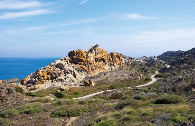
The historic stripe paths form a branched network that connects all the small bathing bays of the Costa Brava and which in the past was mainly used by smugglers and security guards. As Hiking trails have only recently been re-opened, lead over long stretches under fragrant pine trees through the most beautiful sections of the local coastal area with magnificent views of the various bays. From time to time you also come across one of the old watchtowers.
strip path «Roses -> Cala Montjoi»
The Historical Stripes Trail «Roses -> Cala Montjoi» Follow a narrow path, right along the shore, From Almadrava Beach to Cala Montjoi, and leads along steep cliffs and rugged cliffs. Characteristic is the Typical Mediterranean vegetation with pine trees and low bushes. The route is ideal for a refreshing swim in between, because small bays and attractive stretches of beach line here like pearls in a chain. The Strip Trail starts at the last house in the Carrer Gauguin on Almadrava Beach, where the Cap de Creus Nature Park also begins.
Punta Falconera – Cala Lladó – Cap Trencat – Cala Murtra – Cap Blanc – Cala Rostella
 After about 1 km you come to Punta Falconera, which owes its name to the falcons that were often seen here years ago.
Until the 1990s, this rocky nose was a restricted military area due to its strategic importance, as you could see the entire Bay of Roses unhindered from here. As a result of this use of the site, one also encounters again and again Underground galleries with bunkers and gun shooting ranges. After the Punta Falconera, the path follows, uphill and downhill, the far abrupt terrain, crosses pine forests and leads us to steep rocky slopes and various small bathing bays. First you reach Cala Lladó. In the past, marble was mined here, which was then transported over the sea to Roses. The loading area and the ramp, over which the large blocks to the ships were lowered, are still clearly visible today. In the further course of the route we pass this Cap Trencat (Trencat = «broken» due to the boulders that come loose again and again and fall into the sea) and come to the nudist beach Cala Murtra (from Murtra = «Myrtle», a plant species widely used here) and then, behind the Cap Blanc, to Cala Rostella. On this stretch of coast there are numerous cliffs just below the water level, called Baus, which in the past many ships stranded and set – today an attractive ambience for many divers.
Cala Montjoi
Finally, the Stripenweg brings us to Cala Montjoi, from which two old farmhouses can be seen in the back of the valley, the Mas de Montjoi de Baix and that Mas de Montjoi de Daltwho once filled the area with flourishing life.
R6 – approximate length:
5 hours (back and forth)
Difficulty level:
medium difficulty
More: Fancy hiking: Camí de Ronda, Between the rock face and the Mediterranean – Camí de Ronda, Camí de Ronda – Sa Tuna direction Sa Riera.